NavList:
A Community Devoted to the Preservation and Practice of Celestial Navigation and Other Methods of Traditional Wayfinding
From: David C
Date: 2017 Jan 30, 20:06 -0800
AFAIK there are only three scheduled commercial flights across the southern ocean between NZ and South America. While looking at Flightradar24 the other day I noticed two of these flights racing nearly neck and neck toward South America. The departure between them was only about 17'. However the dlat was quite a bit larger..............
Then a what-if question entered my head. What if each aircraft lost all navigation equipment except for one compass and voice radio via satellite? Assume that when the equipment started failing both crews had the foresight to find a pen and piece of paper (car park receipt?) and write down some critical numbers.
In a stroke of genius each captain got onto the PA and said "Is there a Navlist member onboard?". Of course the answer was yes otherwise this post would be pointless (-;
Each navlist member had with him some pencils, an eraser, some paper, a copy of Norie, the Air Almanac, Nicholls's Concise Guide to The Navigation Examinations vol II (1968) and Martin's Air Navigation (probably 1930s). The navlist members were obviously from the UK or colonies. Unfortunately their calculators and Bygraves were in checked luggage. They suspected that their bubble sextants and 229 were in carry on luggage but were not sure. Because they were travelling to SCL they had each doodled 33 23 34 S 70 47 08 W on the backs of their hands.
See aircraft3b_modified.jpg for the flightradar24 image.
See aircraft_summary.txt (or below) for the details. Because the working was done in stressful, emergency conditions there may be some errors (-;
******************************************* Time ****************************************************
Both navlist members were wearing quartz watches. They had set them to UTC while waiting in the departure lounges (via airport wifi).
************************************* Great Circle Initial heading ************************************
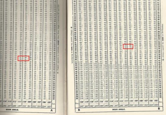
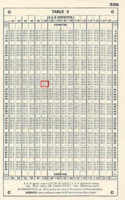
Their first step was to make sure the aircraft were heading in the correct direction. An easy way to calculate the intial heading of a great circle is the ABC tables in Norie.
LAN 800 dlong 110° 31.7' (aircraft - SCL)
lat1 39° 30.7' S (aircraft)
lat2 33° 23.5' S (SCL)
A S 0.31 HA between 90 & 270 so A same name as lat1
B S 0.69 Same name as lat2
Same names so add: C 1.00
From which azimuth = S 52° E = 128°. The aircraft's track is 113°.
(aircraft_abc_1_scaled.jpg & aircraft_abc_2_scaled.jpg )
Repeating for QFA27 azimuth = 126° which is identical to the aircraft's track.
********************************* Great Circle Distances *************************************************
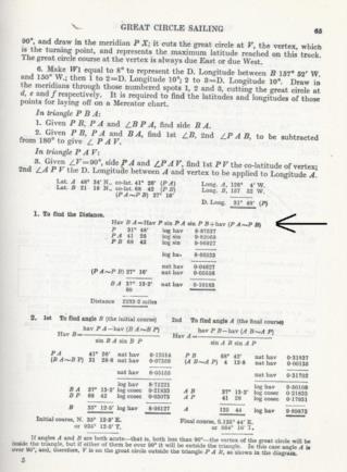
AKL and CHC have been closed by fog so the aircraft are committed to continuing to SCL. What is the distance? The first plan was to use a calculator (if they had had them with them) and the easily remembered cos formula. Unfortunately because the HA is > 90 the cos formula will not work. Opening their copies of Nicholls's they find the following formula:
hav(dist) = hav(HA) * sin(co-lat1) * sin(co-lat2) + hav(l1 ~ l2)
(aircraft_gc_1_scaled.jpg)
Here is the working for LAN 800:
co-lat 1 50° 29.3 lsin 9.88733
co-lat 2 56° 36.5 lsin 9.92165
dlong 110° 31.7 lhav 9.82951
Sum lhav 29.63849
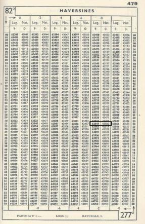
natural hav 0.43500 (aircraft_hav_1_scaled)
l1 ~ l2 natural hav 0.00906
sum 0.44406
Distance = 83° 33.8'
= 5014nm
Appproximate time to SCL 10 hours
A similar calculation for QFA27 gives:
co lat 1 39° 33.8' lsin 9.80409
co lat 2 56° 36.5' lsin 9.92165
dlong 109° 56.7' lhav 9.82645
Sum lhav 29.55217
natural hav 0.35660
l1 ~ l2 natural hav 0.00906
sum 0.36566
Distance = 74° 24.8'
= 4465nm ????
Approximate time to SCL 7 hours 20 min (? not sure of these numbers)
********************************* DR Position ******************************************************
After one hour had elapsed DR positions were determined so that new GC courses could be calculated. Here are the results for QFA27:
G/S 605 kt
track 126°
Distance in one hour 605nm
Lat 50° 26'
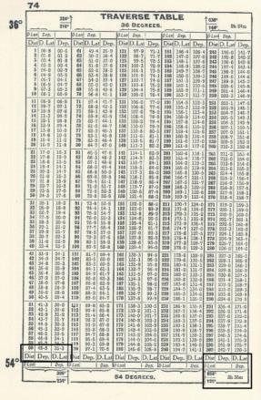
From Norie's traverse tables dep = 485'
dlat = 353' (5° 53')
(aircraft_traverse_1_scaled.jpg)
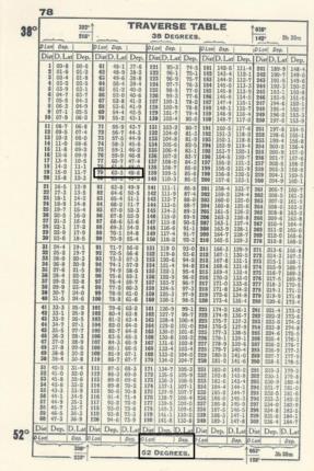
Using (50 + 5/2 approx = 52 ) as middle lat dlong = 790' = 13° 10'
(aircraft_traverse_2_scaled.jpg)
From which DR position is 50° 26.' + 5° 53 = 56° 19.2' S
179° 16.2' + 13° 10' = 167° 34' W (crossing 180° meridian)
From this a new GC track can be calculated. (Note that we are ignoring the wind)
QFA 27 dlong 96° 46.7' (aircraft - SCL)
lat1 56° 19.2' S (aircraft)
lat2 33° 23.5' S (SCL)
A S 0.26 HA between 90 & 270 so A same name as lat
B S 0.66 Same name as lat2
Same names so add: C 0.92
From which azimuth = S 63° E = 117°
********************************** Celestial Navigation *******************************************
The navlist members discover that in their carry on bags are a bubble sextant and vol 1 of 249. The QFA27 data is:
UTC 0627 + 1 = 0727
Date 29 Jan 2017
DR Position 56 19.2 S 171 3.8 W
Speed 605 kt
Altitude 31,000 feet
GHA Aries 1 Jan 2017 100° 50'
incr 29d 07 hrs 132° 53'
incr 27min 6° 46'
GHA Aries (sum) 248° 29'
Assumed long 171° 3.8' (west subtract)
LHA aries 69° 25.2'
Assumed lat 56° S
Track 117°
The following stars are chosen:
Peacock 31° 55'/213°
Sirius 43° 17'/046°
Rigel Kent 28° 56'/164°
The captain was unwilling to turn the aircraft so a sight of diphda (298°) could not be taken.
The next step is to look out of the windows to see if the moon is visible. So far they have been too busy to do so.
******************************** Intercept *********************************************************
The crew of LAN 800 noticed that their only working compass was behaving erratically. They requested that QFA27 intercept them and guide them to SCL.
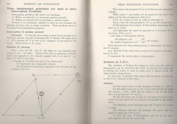
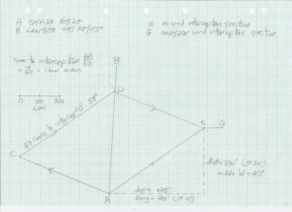
Fortunately the navlist member on QFA27 had a copy of Martin's Air Navigation. This book describes a graphical technique to plan the intercept.
(aircraft_intercept_1_scaled.jpg)
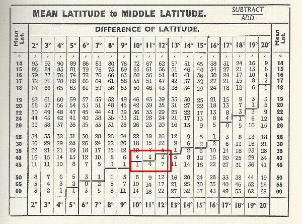
The first step is to determine the distance between the aircraft by a middle latitude sailing. The mean latitude is 44° 58'. A table in Norie (aircraft_middle_1_scaled.jpg) indicates that middle latitude can be assumed equal to mean latitude.
dlat = 10° 55.5'
dlong = 0° 24.9'
From Norie's traverse table with a middle lat = 55° dep = 17.7' the bearing from QFA27 to LAN800 is about 2.5° and the distance approximately 660nm.
The course to intercept is 57° and the time to intercept 1 hr 14 min.
From the position at which QFA27 changes course the intercept position is dlat 5° 30' dlong 11° 10'
(aircraft_intercept_2_scaled.jpg)
******************************************* Critical (Equal Time) Point **************************************
The navlist member on QFA27 never travels without his copy of Worthington's Flight Planning. He quickly turns to page 63 and confirms that the critical (equal time point) is given by the formula
Distance to CP = D X H /(O + H)
D total distance
H G/S Home
O G/S out
Assume that QFA27 has a 100kt tail wind.
O = 605kt
H = 405kt
Distance to CP = D X 0.4
The time to the point of no return is 0.4 X endurance
(aircraft_critical_1_scaled.jpg)
******************************************** Wind *******************************************************
The flights have many hours to go so the navlist members must determine the wind. Martin's gives several methods for finding wind but unfortunately they rely either on a drift sight or on a bearing of a distant object. The navlist members are still working on this problem.
The most promising method involves celestial fixes.

