NavList:
A Community Devoted to the Preservation and Practice of Celestial Navigation and Other Methods of Traditional Wayfinding
Re: Whaling logbooks
From: Don Seltzer
Date: 2016 May 20, 16:50 -0400
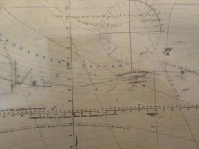
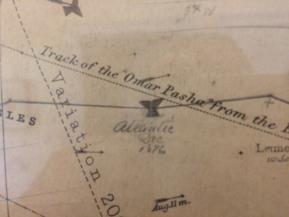
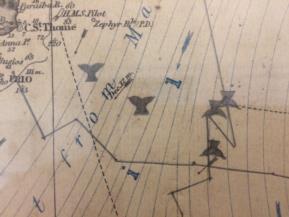
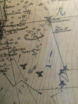
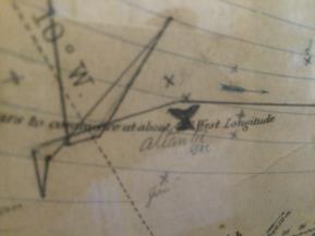
Here the track becomes a bit confusing with the annotations. At roughly 37S 24W is the notation 'Atlantic Dec'. Surrounding it are eight small crosses, two of which are labelled Jan. But hundreds of miles to the east, at about 37S 6W there is a similar notation of 'Atlantic Dec 1876'. And halfway in between is a grouping of about four crosses, one of which is labelled Feb. Clearly there is an inconsistency here. And further north is another track terminating at about 34S 8W.
My guess is that the 'Atlantic Dec' labels are simply identifying the track of the ship after it left the Brazilian coast in Dec 1876 on its way across the Atlantic towards its subsequent cruise in the Indian Ocean. That other mysterious track to the north must have been for another voyage, perhaps another ship.
Any proof that Henry Gifford might have provided of his navigational skill would have been in the form of a regular journal, rather than this casual chart.
Don Seltzer
From: Don Seltzer
Date: 2016 May 20, 16:50 -0400
I have doubts that the chart was used as any sort of proof of navigational abilities. It lacks any specific data regarding dates, only a few crosses with the month, and others completely unlabelled. I suspect that it was more of a casual record of the voyage.
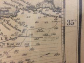
Perhaps the solid line represents the actual track of the ship as recorded in the official ship's log by the Master, Benjamin Wing. The small x's might have Henry's attempts at navigation as a novice. It appears that the ship sailed from New Bedford, spent some time near the Cape Verde Islands (the crew list has half a dozen hands from Cape Verde and the Azores; they might have signed on at this time), and then fished the south Atlantic off Brazil.On Fri, May 20, 2016 at 10:13 AM, Ian Gifford <NoReply_Gifford@fer3.com> wrote:
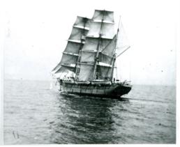
...so if the above is correct this original 1876 navigation chart [see attached JPGs] I have been looking at for 50+ years is not only a partial catch record (see whale tales he inked in) for the Whaling Bark Atlantic 1876-79 voyage going to the Indian Ocean around the Cape of Good Hope but also the navigation PROOF he needs to become a captain of his own whaler. My guess is the reason his decendants have this chart vs. the Whaling Agent J. & W.R. Wing & Co. is that this is HIS chart and was used to qualify for a Captain's rank. Maybe he was the First Mate?
Attached File:
Attached File:
Attached File:
Attached File:
Attached File:
Attached File:
Attached File:
Attached File:
Attached File:
Attached File:
Attached File:
