NavList:
A Community Devoted to the Preservation and Practice of Celestial Navigation and Other Methods of Traditional Wayfinding
From: Frank Reed
Date: 2016 May 20, 12:14 -0700
Ian Gifford, you wrote:
"Q1 In looking at the pictures (sorry for the poor quality) are the plot lines just typical fishing movements or is their some strategy i.e., navigation movements? "
Well, they appear to be a mix of the actual track of the vessel on some leg of its voyage and individual positions at other points in the voyage. This may have been drawn up from the logbook after the voyage, but I do like your theory that this might have been something prepared as a resumé proof. The whale tails tell us where they sighted and pursued whales and also where they killed whales. Normally the inverted tails would represent kills.
You asked:
"Q2 Is the Master (Benjamin Franklin Wing) the navigator? Did they have more than one navigator? Why would my ancestor track the vessel and indicate whale catch by Lat/Lon on this chart and not turn it in to the owner/agent? "
It would not be unusual for the master of the vessel to invite anyone else interested to participate in the navigation. Why put it on a chart? And why not make it an official document? Well, whaling was boring most of the time. Consider all the beautiful work done in scrimshaw. The crew had plenty of free time, and just as a modern sailor might track a voyage even when sailing as a passenger, this chart (if it was created during the voyage) may have served to fill the time.
You wrote:
"Q2 What navigation tools would a typical Whaling ships navigator have access to? I can see the divider marks on his original chart as well as his running fix in pencil on the chart, etc. Did they use half-horizon mirror sextants? Chronometer? Barometer? Taffrail or ships Log? Parallel Rulers? What else? "
Pencils, yes, common drafting instruments depending on the individual, and of course individual navigators would have owned their own sextants. By this date octants were considered old-fashioned, low-class. And there would normally have been two or more chronometers aboard, but I don't know how many of these were property of the captain and officer or if any were owned by backers/owners of the ship. The vessel's own complement of tools would have included a taffrail log and probably barometer and thermometer (for weather, probably only rarely considered for correcting celestial sights for unusual conditions).
You asked:
"Q3 What was the typical Whaling navigator using to create a fix? Sighting the sun at solar noon? Polaris at night? Lunars? Horizontal DR tool when piloting? Longitude by chronometer? Etc. Note: I know I should take Frank's popular workshop... "
Of course you should. :) For sights, my sense is that navigation was relatively uniform in the latter half of the 19th century on all but the fastest vessels. They used Noon Sun for latitude, advancing by DR as required, and they got longitude by morening and afternoon time sights (also known as "longitude by chronometer"). Lunars were over and done with by about 1850, though as with any historical rule you can find exceptions if you dig long enough. Polaris at night for latitude had some popularity on American vessels, but it wasn't a "common" sight. Shooting Polaris for latitude seems to have been superfluous for most navigators. And of course it's only possible in latitudes north of about 3° - 5° North. For coastal piloting, I have no real evidence except that they had no unusual tools. No doubt they used the compass for approximate bearings, and that was usually good enough. Also bear in mind that most ports visited by whaleships had pilots and tugs for hire. The Charles W. Morgan, for example, did not sail in and out of San Francisco in the 1880s/90s. She was towed. The knowledge of the local pilots assured her navigation and safety.
You wrote:
"Q4 What was the typical Whaling navigator using for charts and books? I can see that the chart was printed the year before the voyage and then stamped by the James Imray and Son the year of departure; apparently they published an extensive list of charts and pilot books. My guess is: Bowditch [...]"
I would expect several books. Bowditch was one among many, and it was valued as much for its encyclopedic data, like lists of latitudes and longitudes of distant places, as anything else. The navigators aboard the Atlantic, including your ancestor, may well have learned their navigation methods from a Norie or a Raper or any number of other navigation manuals. A lot of it would depend on who they learned from. You wondered whether they might have used an old edition of a navigation text, and yes, certainly that would be the case for basic navigational methods. Little changed in practical navigation from in the middle half of the century. As for Bowditch, there was really very little difference between the last edition published while Nathaniel Bowditch was alive in 1837 and the last printing made from the now US govt-owned plates through the 1870s. The big change arrived in 1881 when a massive revision of the work was released. That really changed everything.
You concluded:
"FWIW the Whaling Agent J. & W.R. Wing & Co. owned or had a stake in the Charles W. Morgan as well as most of the New Bedford Whaling Fleet."
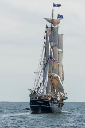
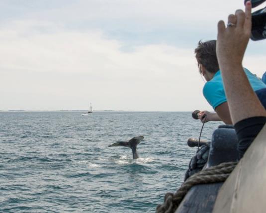
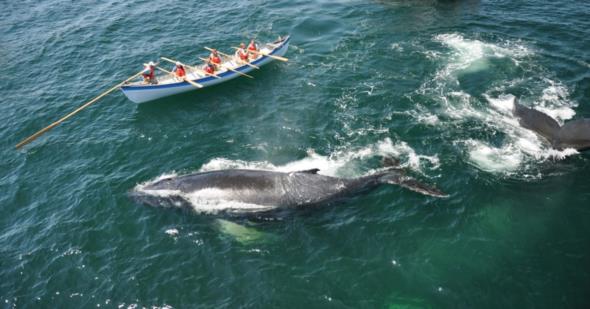
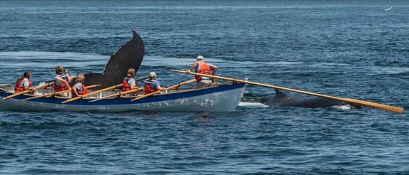
Yes, and the "W" Wing flag still flies from the highest point. I'm including some photos here of the Charles W. Morgan under sail among the whales north of Cape Cod on July 11, 2014. Zoom in, and you'll see the "W" flag. At the moment when this photo was taken, I was making my way to the port side, and I am about to call out "Holy Cow!" when I see that whale so close alongside. As it happened I was standing right next to one of Mystic Seaport's sound guys who captured my exclamation. It has since been fitted into several of the videos at appropriate points. I got to hear myself say "Holy Cow" on the CBS Evening News a couple of weeks later.... So I got that goin' for me, too. Heh.
Frank Reed


