NavList:
A Community Devoted to the Preservation and Practice of Celestial Navigation and Other Methods of Traditional Wayfinding
Re: Upper limb correction for moon
From: Gary LaPook
Date: 2013 Sep 11, 01:16 -0700
From: Gary LaPook
Date: 2013 Sep 11, 01:16 -0700
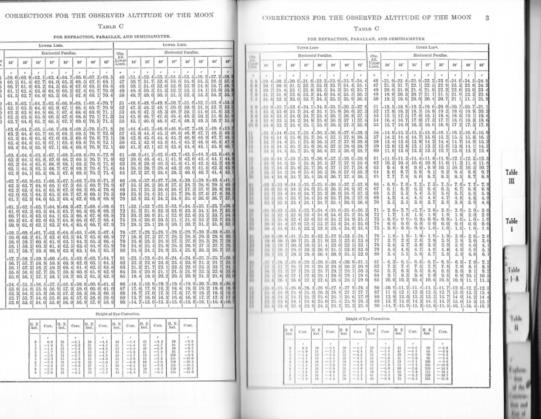
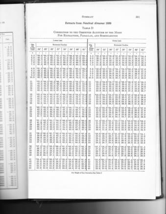
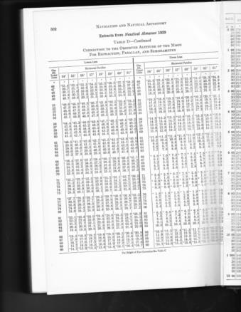
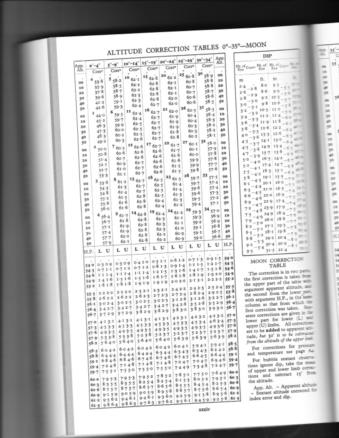
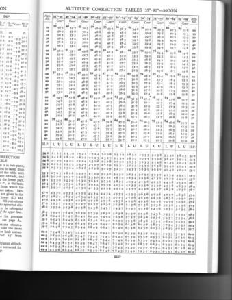
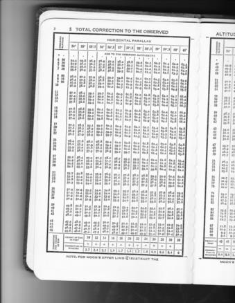
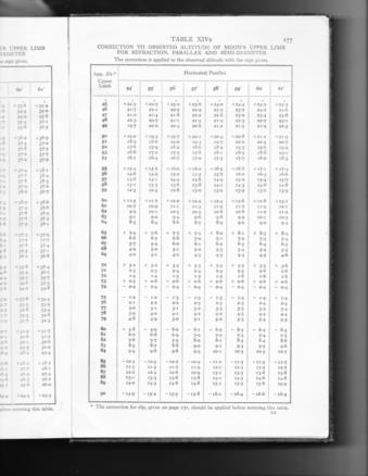
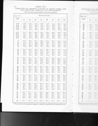
There are other tables to use to compute the correction for an upper limb shot of the moon, and I have attached some of those other tables. We can compare the results we get with each table.
Assuming Hs= 33° 28'
Height of eye= 35 ft
SD = 15.0
HP=55
With the current Nautical Almanac you get Ho = 33° 51.8'
With the 1939 Nautical Almanac Ho = 33° 51.7'
With HO 208 Ho= 33° 51.7'.
With HO 211 Ho = 33° 51.7'
Hughes tables Ho= 33° 51.5'
Weems Line of Position Book doesn't have corrections for upper limb.
The Air Almanac produces Ho= 33 51'.
Only the Air Almanac does the calculation is individual steps, Hs; dip; Ref; SD; and finally P in A. All the others combine REf; SD, and P in A. All of the other tables combine Ref; SD; and P in A. Some of the tables also include dip.
Take your choice.
gl
From: Gary LaPook <garylapook@pacbell.net>
To: garylapook@pacbell.net
Sent: Tuesday, September 3, 2013 12:51 AM
Subject: [NavList] Re: Upper limb correction for moon
I've always disliked the way that all the corrections for the moon are incorporated into one table since it gives the student no idea what is really going on. I prefer the method used in the Air Almanac which has a table on each page for the parallax in altitude correction based on the current horizontal parallax of the moon. This keeps each correction separate. You apply IC, Ref, SD and then P in A. This way it all makes sense. I have attached today's page.
And while we are at it, I prefer the "Q" table for Polaris sights for the same reason.
gl
From: Frank Reed <FrankReed{at}HistoricalAtlas.com>
To: garylapook{at}pacbell.net
Sent: Sunday, September 1, 2013 1:58 PM
Subject: [NavList] Re: Upper limb correction for moon
----------------------------------------------------------------
NavList message boards and member settings: www.fer3.com/NavList
Members may optionally receive posts by email.
To cancel email delivery, send a message to NoMail[at]fer3.com
----------------------------------------------------------------
And while we are at it, I prefer the "Q" table for Polaris sights for the same reason.
gl
From: Frank Reed <FrankReed{at}HistoricalAtlas.com>
To: garylapook{at}pacbell.net
Sent: Sunday, September 1, 2013 1:58 PM
Subject: [NavList] Re: Upper limb correction for moon
Hello cdtkumar.
You asked:
"why do we subtract 30' for the correction of altitudes for the moon in upper limb only and not for the lower limb? what is this correction for and why do we need to apply it for upper limb only and not for the lower limb?"
"why do we subtract 30' for the correction of altitudes for the moon in upper limb only and not for the lower limb? what is this correction for and why do we need to apply it for upper limb only and not for the lower limb?"
That's a good question, and many people have puzzled over it. It's potentially confusing since 30' sounds an awful lot like the diameter of the Moon, but it's not quite right. As it turns out, that seeming "clue" is leading us in the wrong direction. In fact, the 30' correction is relatively arbitrary (within some range --it has to be close to the Moon's diameter but the exact value is chosen arbitrarily, for convenience). The short answer to the question is that we subtract 30' because the table for the Upper Limb was calculated by adding in 30' to make life easier for us manual calculators. That, of course, leads us to
the next question: why the heck did they calculate the table with 30' arbitrarily added in?? The answer to this second question is sometimes hard to see today since manual calculation is such a rare activity. Manual subtraction is mode difficult than addition, and it is considerably more prone to error. The 30' subtraction at the end saves us from a more difficult subtraction at an earlier step. If the actual correction were tabulated for the Upper Limb, it would be sometimes positive and sometimes negative (you can easily assemble a table for the net LL and UL corrections yourself). You'll find that you get negative numbers for some altitudes in the UL table. From a printing perspective, the tables would require some obvious indication of a sign change in the UL numbers. A working navigator would have to subtract some number like 13.6' instead of adding 16.4' and then subtracting 30' at the end. It's MUCH easier in manual calculation to subtract a nice
round number like 30' than it is to subtract something like 13.6'. So this organization of the work, shifting the subtraction off to a nice round number at the end, simplifies the calculation leaving less room for error and also simplifies the Moon correction tables from a printing perspective. This idea of adding in an arbitrary "round number" constant at the beginning in the tables and then subtracting it off at the end manually has been a part of navigational calculations since at least 1804 and probably earlier. It's a good trick!
-FER
----------------------------------------------------------------
NavList message boards and member settings: www.fer3.com/NavList
Members may optionally receive posts by email.
To cancel email delivery, send a message to NoMail[at]fer3.com
----------------------------------------------------------------
: http://fer3.com/arc/m2.aspx?i=125033
Attached File:

Attached File:

Attached File:

Attached File: 125064.polaris q table.pdf (no preview available)
Attached File: 125064.sept 3, 2013.pdf (no preview available)

Attached File:

Attached File:

Attached File: 125064.polaris q table.pdf (no preview available)
Attached File: 125064.sept 3, 2013.pdf (no preview available)
: http://fer3.com/arc/m2.aspx?i=125064
