NavList:
A Community Devoted to the Preservation and Practice of Celestial Navigation and Other Methods of Traditional Wayfinding
From: Don Seltzer
Date: 2013 Nov 19, 13:24 -0800
Frank wrote:
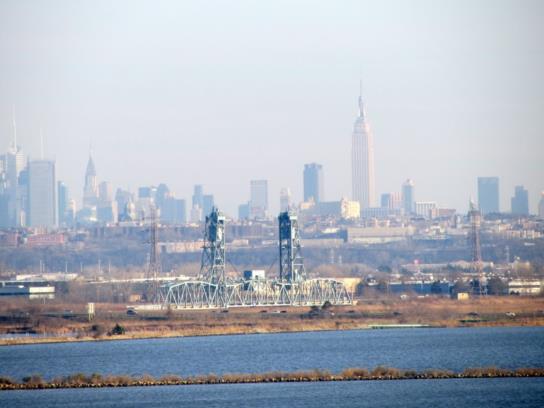
There are some foreground features that really narrow things down dramatically. Did you notice the high tension power line tower lined up with a church steeple just below the right horn of the eclipsed sun? And towards the left, just visible in the dark part of the image, there's a bridge structure of some sort with a little red light at the top. It turns out that this bridge has a nice utilitarian New Jersey name: it's the "Upper Hack Lift Bridge" (an NJ Transit railroad bridge crossing the Hackensack River) and the power line tower visible in the photo is located just to the southeast of the bridge. The church is apparently St. Joseph's in Union City, NJ, so we're really seeing two skylines superimposed.. Since the railroad bridge is about 1.7 n.m. away and the church steeple about 4.1 miles away and the Empire State Building is about 6.7 n.m. away, relatively small changes in the estimated position of the photographer would shift their apparent overlap in the image substantially. If you move twenty feet, the position of the foreground features (bridge and tower) would shift by 3 minutes of arc relative to the mid-ground (church steeple) and 5 minutes of arc relative to the background (Manhattan skyline). And of course, with Google Street View and the linked 'Panoramio' images nearby, it's not difficult to find close matches. That put my best guess right at the entrance to the "James Zadroga Memorial Soccer Field" right across the street from the cemetery. Twenty feet north or south of there would not match. Narrowing the position along the perpendicular direction is tougher, but since the terrain slopes up to the west rather sharply here, if the photographer was, in fact, across the street in the cemetery, he could not be very far up the hill. Certainly no more than a hundred feet west of here. I'm attaching an image taken from very near my guess for the photographer's location with the original eclipse photo's frame outlined and an ellipse drawn in to represent the rising sun.
Here is a clearer photo from the same spot at the entrance. Looks like a near perfect match to the sunrise photo.
Don Seltzer
----------------------------------------------------------------
NavList message boards and member settings: www.fer3.com/NavList
Members may optionally receive posts by email.
To cancel email delivery, send a message to NoMail[at]fer3.com
----------------------------------------------------------------


