NavList:
A Community Devoted to the Preservation and Practice of Celestial Navigation and Other Methods of Traditional Wayfinding
Re: Navigation with Moon images
From: Peter Monta
Date: 2020 Aug 27, 09:19 -0700
From: Peter Monta
Date: 2020 Aug 27, 09:19 -0700
Hi Greg,
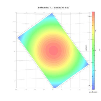
Attached are some results on the JPEG file you sent. It looks pretty good. Plate scale is 22.10 arcseconds per pixel. There is some third-order distortion, amounting to ~100 arcseconds away from the best-fit tangent plane at the image corners---totally normal for a wide-angle lens like this.
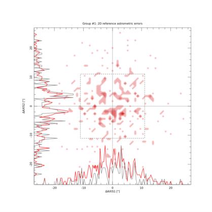
The first plot shows the position differences between detected stars and their catalog positions (I used Tycho-2). The majority are within a 10-arcsecond radius (~0.5 pixel). This is one area where a RAW file really helps---the centroiding expects linear light, but JPEG has put a large nonlinearity into the mix. JPEG also colors the noise, so instead of nice white noise you have this granular background. SNR thresholds must be raised to avoid many false detections, and this hurts the overall sensitivity. Not a huge deal for this image, since there are plenty of stars (about 340 that the SCAMP tool considers a good match).
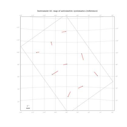
The second plot shows some estimates of systematic errors in the astrometry averaged over a portion of the image (after distortion correction). It says a few arcseconds, but this may be too optimistic. I would not trust details in the statistics based on a JPEG image. The third plot shows the distortion map, but all you can really see is the bullseye of the tangent-plane (gnomonic) projection---the higher-order distortions are invisible at this scale.
Also attached is the FITS header for the full distortion solution. This can be used with, for example, the xy2sky command-line program from WCSTools. If you have two objects in an image with pixel coordinates (x1,y1) and (x2,y2), then xy2sky will tell you the (ra,dec) coordinates of them with the distortion correction applied, and then you can calculate the angle between them. This works for any image taken with the same lens---the actual sky coordinates don't matter, just the angle between the two corrected points.
For interactive use, Deep Sky Stacker [1] might be quicker for getting positions of just a few features in an image. It will read RAW files, do the astrometry, and show celestial coordinates of any selected pixel or object. It might be possible to substitute in a daylight image and still have access to the coordinate tools.
Cheers,
Peter


