NavList:
A Community Devoted to the Preservation and Practice of Celestial Navigation and Other Methods of Traditional Wayfinding
From: Frank Reed
Date: 2021 Aug 30, 08:54 -0700
Tony, you wrote:
"just take a star globe (like this one), then "simply" turn and tilt it so that it comes into perfect correspondence to the sight of the sky above you. The rest is easy: your latitude is read on the altitude scale (against the elevated pole), your longitude is obtained by reading the SHAAries (or RA as on several globes is printed) against the meridian ring adding it with the GHAAries taken from NA for the moment of that observation."
Exactly. And while they're certainly convenient (and fun toys!), you don't need a star globe if you have a basic star atlas or a similar app. Just "look straight up" and estimate the location among the stars of the zenith. If you see a bright star right at the zenith, well, congratulations! But that rarely happens so you usually need to look at two or three stars. As an example, you might notice that the zenith falls more or less right at the center of the triangle made by Betelgeuse, Procyon, and Sirius. You get out your star globe or star atlas. You find that spot among the stars. And you record the RA (or SHA) and Dec to the nearest several degrees. Directly the Dec is your latitude, estimated to a few degrees, and with a little math to calculate the RA or SHA of the meridian at Greenwich at the instant of time, your longitude is just the difference (your longitude = HA at your location - HA at Greenwich; equivalently your longitude = GHA of your zenith star). And of course, as I noted in a prior post to Duane, this basic principle is "baked in". It's not another method of celestial navigation. It is the essential foundation of standard celestial navigation. Many would-be navigators miss this foundational principle on first pass because they're taught celestial navigation "by rote" in a baffling alphabet soup of jargon and tables and procedures to be followed, quite often delivered by instructors who learned the system by rote and barely understand the fundamental concept themselves.
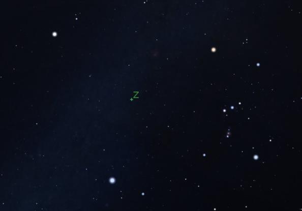
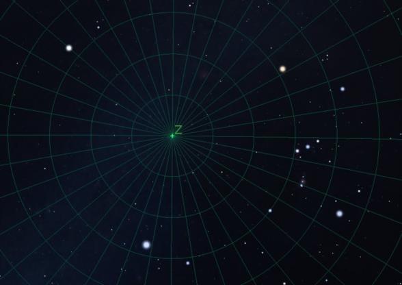
Can we navigate this way? Can we just look at the zenith?? Well, no, of course not, except in rather general, low accuracy terms or if we're using specialized instrumentation on land. The problem with this is not a matter of principle --it's practicality. You can't easily find the zenith with better than a few degrees of accuracy unless you're using a specialized instrument... In the image attached here, I'm illustrating that spot in the sky nearly centered in the triangle formed by Betelgeuse, Procyon, and Sirius. In this case, it's marked with a Z for zenith. Life would be simple if that little marker existed!! And as illustrated in the second image, life would be simpler still if we could read the coordinates of the stars directly off the sky...
Frank Reed


